
The Manchac Swamp: History, Ecology, and the Real Story
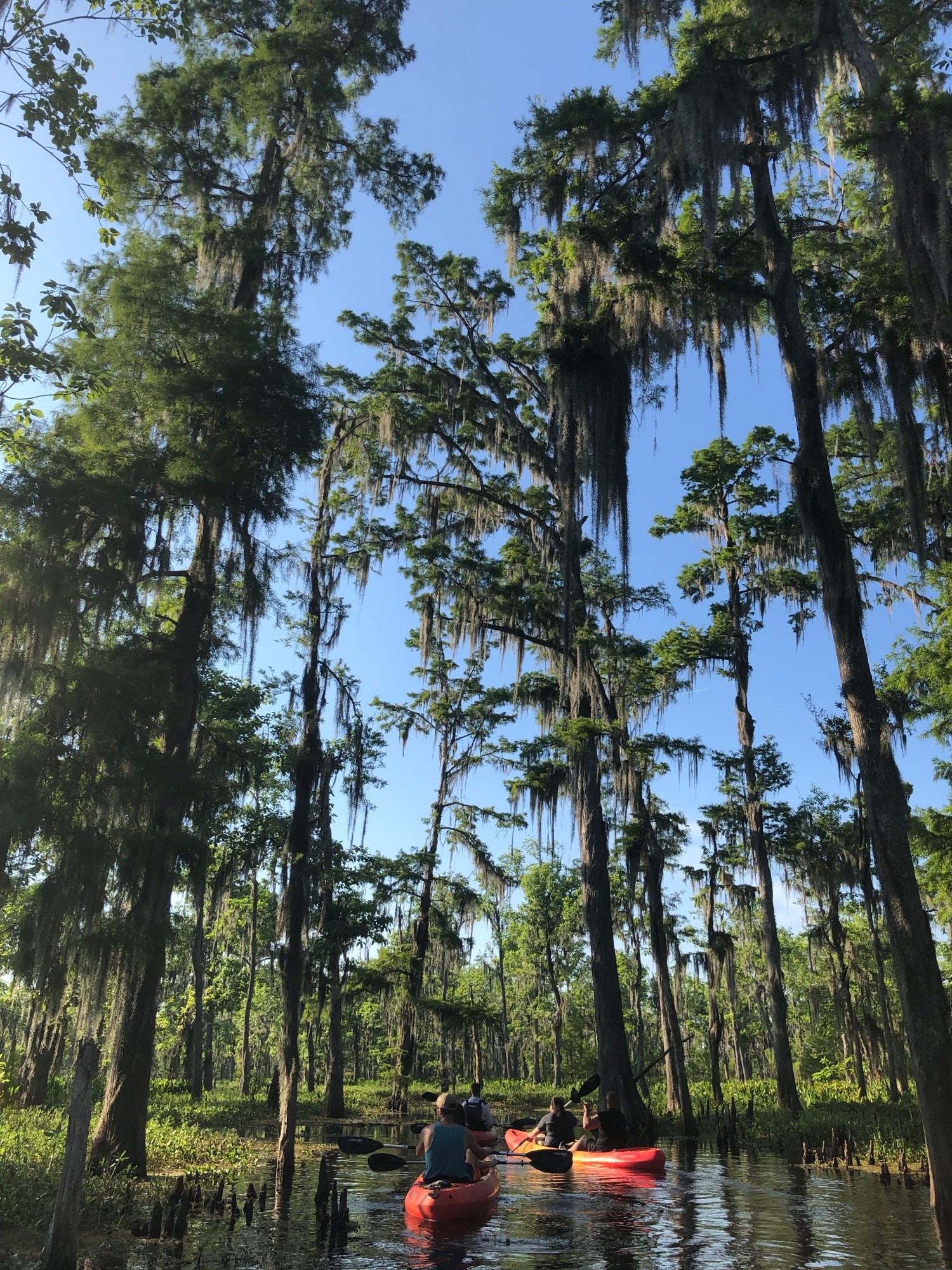
Most people meet the Manchac Swamp through a car window, doing 70 on the I-55 bridge, and never learn they just crossed a graveyard. Two towns are under that water. So is the tail end of an international border, a clear-cut cypress forest, and one of the best wildlife corridors left in southeast Louisiana. This is the long version, the one the ghost tours skip.
We run guided paddles out here, so we get the same questions on repeat. Is it haunted? Why do the trees look dead? What’s that name mean? Fair questions, all of them, and the real answers are better than the campfire ones.
Manchac is two waterways, and people mix them up constantly
First thing to untangle, because half the internet gets it wrong. There is a Bayou Manchac and a Pass Manchac, and they are not the same place.
Bayou Manchac is up near Baton Rouge, a former channel of the Mississippi that once carried water east toward the lakes. That is the one with the colonial-border history (more on that in a minute). Pass Manchac is the roughly 7-mile channel that connects Lake Maurepas, the smaller western lake, to Lake Pontchartrain, the big one on the New Orleans side. When people say “the Manchac Swamp,” they almost always mean the cypress country around Pass Manchac and the lakes. That is the water you paddle.
So the swamp sits in a low, wet basin between two lakes, threaded by a pass, about 30 to 45 minutes northwest of downtown New Orleans. Close enough to be a half-day trip. Wild enough that you forget the city exists.
The name means “back door,” and that is the whole story
“Manchac” comes from the Choctaw. The linguist John R. Swanton traced it to Imashaka, which breaks down to roughly “the rear entrance.” Back door. Shortcut.
That is not a random name. It is a description of what the waterway did. Long before Europeans showed up, the peoples of this region, the Bayougoula, the Acolapissa, the Houma, knew you could skip the long, dangerous mouth of the Mississippi and slip between the river and the Gulf through the back way: up Bayou Manchac, across to the Amite River, into Lake Maurepas, through Pass Manchac into Pontchartrain, and out. A rear entrance to the whole system.
When the French explorer Pierre Le Moyne d’Iberville came through in the spring of 1699, a Bayougoula chief told him about the shortcut. Iberville took it on March 24, 1699, and promptly renamed the bayou after himself, the Iberville River, the way explorers did. The Choctaw name stuck anyway. Sometimes the back door outlasts the guy who barged through it.
The swamp was once an international border
Here is a fact that surprises even a lot of Louisiana natives. Bayou Manchac was once the line between two empires.
After the French and Indian War in 1763, the map got carved up. Bayou Manchac and the old Iberville River became the northern edge of the “Isle of Orleans” and the boundary between British West Florida to the north and Spanish Louisiana to the south. The British built a garrison, Fort Bute, right at the mouth of the bayou where it met the Mississippi, to watch the traffic and skim the fur trade.
It did not stay quiet. In September 1779, Spain’s governor of Louisiana, Bernardo de Gálvez, marched on Fort Bute and took it, one of the opening moves of Spain’s entry into the American Revolution on the side of the colonies. The British had already pulled most of their men back to Baton Rouge, so the fort fell fast. Still: the sleepy swamp back door was, for a stretch, a piece on the board of a world war. You would never guess it from the herons.
The towns the water took
By the late 1800s the shortcut had a railroad running through it. The Illinois Central line strung a handful of little towns along the edge of Lake Pontchartrain, and for a few decades they had a real life.
- Ruddock was a cypress sawmill town, incorporated around 1891, with a post office, a telegraph office, a train engine shop, and a boarding house. Loggers, mostly.
- Napton (older name Wagram) was a smaller farming stop a few miles down the line.
- Frenier was farther south and famous, locally anyway, for cabbage. They grew it in the swamp muck and shipped it by rail all the way to Chicago.
No roads reached these places. The railroad was everything: groceries in from New Orleans, logs and cabbages out. And then, on September 29, 1915, an unnamed Category 4 hurricane came ashore near Grand Isle around 8 in the morning with sustained winds near 145 miles an hour, the strongest storm the region had recorded up to that point (NOAA’s Hurricane Research Division has the full record).
The lake came up and went straight through the towns. In Frenier, people who sheltered in the railroad depot died when it collapsed on them. Ruddock was flattened and never rebuilt. The storm killed around 275 people across the region, with local accounts putting the Ruddock and Frenier death toll in the dozens (sources range from 28 to nearly 60, depending on who counted). The railroad came back eventually. The towns did not. When you hear Manchac called “the swamp of the drowned towns,” that is the literal truth, not a marketing line.
The real Julia Brown, minus the ghost-tour makeup
Every ghost tour on this swamp sells you the same character: Julia Brown, the voodoo priestess who sat on her porch, cursed the whole town, and died the very day the hurricane wiped it out. Great story. Most of it is invented, and the real version is actually better.
Here is what the records support. Julia Brown (born Julia Bernard, around 1845) was a real woman, a literate, land-owning Black resident of Frenier who held a 40-acre homestead. She was, by the accounts of people who knew her, well liked. One neighbor’s oral history remembered her sitting on the porch with a guitar, singing songs she made up herself, and one line went something like “one day I’m gonna die and take the whole town with me.” She died of old age. Her funeral was on September 29, 1915. The storm hit mid-service, and mourners reportedly fled and left her casket behind.
That is a genuinely haunting coincidence, and it needs no embellishment.
Now the part the tours won’t tell you. There is no evidence Julia Brown practiced voodoo or cursed anyone. As the Historic New Orleans Collection lays out, the “voodoo priestess” mythos didn’t really surface until around 2010, almost a century after she died, layered onto an ordinary woman because it made for a spookier tour. The staged crucifix some guides point out as “her grave” is a prop. We tell the legend on our trips because it is part of the swamp’s culture now, and it is a good story. We just tell people which parts are true. Julia Brown deserves that much. If you want the folklore in full, we wrote the whole thing up separately in the full Julia Brown story.
Why the cypress look dead
The single most common question we get on the water: why do so many of the cypress look like gray skeletons?
Short answer, two things happened, and they stacked.
First, the loggers. After the Civil War, lumber companies that had already stripped the Great Lakes forests came south for the bald cypress, which is rot-resistant and gorgeous and was sitting in cheap swampland. Through the late 1800s and early 1900s they clear-cut most of the old-growth cypress around Manchac. Louisiana Wildlife and Fisheries puts it plainly for the Manchac area: nearly all of the original bald cypress was logged, leaving open freshwater marsh behind. Only scraps of the virgin forest survive anywhere in the basin.
Second, the water changed. Levees on the Mississippi cut off the sediment and freshwater that used to feed the basin. Saltwater started pushing up from the Gulf. The land itself is sinking (subsidence). Put those together and young cypress can’t get a foothold, so the forest never grew back the way it fell.
So the ghost cypress aren’t a Halloween prop. They are a logging clear-cut plus a slow-motion saltwater problem, standing in the open. Beautiful and a little grim at the same time, which is Manchac in a sentence.
What actually lives out there
For a place with “drowned towns” in its resume, Manchac is stuffed with life. It sits on the Mississippi Flyway, the continental migration highway, so the bird list alone is worth the trip.
On a normal paddle, in a decent season, you might see:
- American alligators, the headline act, sunning on logs or cruising low in the water
- Wading birds by the dozen: great blue herons, snowy and great egrets, white ibis, and if you’re lucky the pink flash of a roseate spoonbill
- Bald eagles and ospreys, both of which nest in the Manchac wildlife area
- Anhingas drying their wings on snags like little black crucifixes, plus barred owls and woodpeckers back in the trees
- Turtles stacked on every available log
- Nutria, the big invasive swamp rodents, which we’ll get to
- Waterfowl in winter (scaup, teal, gadwall, mallard) when the migrants pour through
We don’t guarantee any single animal, and we won’t bait one to force a photo. That is the whole difference between a kayak morning and an airboat’s marshmallow-throwing gator show. You see what the swamp decides to show you, which some mornings is a six-foot gator ten feet off your bow that has no idea you’re there, because there’s no engine to announce you. (If gators are the whole reason you’re coming, we mapped out where you can actually see alligators around New Orleans.)
One thing worth knowing about the nutria: they aren’t supposed to be here. They’re South American rodents brought to Louisiana in the 1930s for the fur trade, and after the fur market collapsed they went feral and multiplied. They chew out marsh grass by the root in “eat-outs” that speed up the land loss the coast can least afford. Cute from a distance. An ecological headache up close.
Spanish moss is lying to you (it is not moss, and not a parasite)
That gray beard hanging off every cypress? Two things everybody believes about it are wrong.
It isn’t moss. And it isn’t killing the tree.
Spanish moss (Tillandsia usneoides) is an epiphyte, an air plant, and it’s actually a cousin of the pineapple in the bromeliad family. It makes its own food through photosynthesis and pulls water and minerals straight out of the air through tiny scales on its strands. It uses the tree as a place to hang, nothing more. It is not a parasite feeding on the cypress. A single strand can grow past 20 feet.
So when you drift under a curtain of it on a still morning, you’re looking at a pineapple relative surviving on humidity and air. Louisiana is strange in the best way.
A football field of Louisiana at a time
You’ve probably heard the line: Louisiana loses a football field of wetland every hour. It’s the most quoted stat about the coast, and it’s worth getting right, because we care about this place and precision matters.
That “every hour” figure came from the loss rate between roughly 1985 and 2010. According to USGS coastal mapping, Louisiana lost close to 1,900 square miles of land between 1932 and 2010, around a quarter of what it had. That is real and enormous: the state accounts for roughly 90 percent of the coastal wetland loss in the entire continental U.S.
The honest update: the rate has slowed. More recent USGS numbers (2010 to 2016) put it closer to a football field every 100 minutes, thanks partly to a calmer stretch of hurricanes and to restoration work. Still staggering. Just not quite “every hour” anymore, and you’ll see us correct people on that, including other tour operators who like the scarier number. Manchac is inside this story, not outside it. The saltwater and subsidence killing the cypress are the same forces eating the coast.
The bridge, the boardwalk, and 160,000 protected acres
A few landmarks worth knowing before you go.
The Manchac Swamp Bridge carries I-55 across the whole basin on twin concrete trestles running 22.8 miles, with pilings driven around 250 feet down into the muck. It opened in 1979 and it’s the longest bridge on the U.S. Interstate system, one of the longest bridges over water anywhere. You’ve maybe driven it without realizing the swamp underneath had a name, let alone a history.
The land around here is more protected than you’d think:
- Maurepas Swamp Wildlife Management Area covers 112,615 acres, the largest WMA in Louisiana, on the south shore of Lake Maurepas.
- Joyce WMA adds another 42,292 acres north of the pass, and it’s the one with the well-known cypress-swamp boardwalk off I-55 if you’d rather walk than paddle.
- Manchac WMA is a smaller 8,328-acre unit where Southeastern Louisiana University runs its Turtle Cove research station, studying exactly the changes described above.
Add it up and you’ve got well over 160,000 acres of managed swamp in the neighborhood. It’s wild country with a research station and hunting seasons and eagle nests, not a park with a gift shop.
Why we paddle it instead of gunning through it
Here’s the part where I stop being a tour guide and just tell you the truth. You can see Manchac from an airboat. A lot of people do. You’ll go fast, the engine will be loud, and you’ll probably watch someone toss marshmallows to make a gator perform.
Or you can sit in a kayak, ten feet off the water, no motor, and let the swamp forget you’re there.
That second one is the whole reason this company exists. Low and slow is how you actually hear a place that spent a hundred years being logged, drowned, and mythologized. You pass the old railroad bed. You drift under moss that turns out to be a pineapple relative. You watch a heron that has no reason to fly off because you didn’t announce yourself with 300 horsepower. If you’re trying to decide between here and the other swamp, we broke down how Manchac stacks up against Honey Island, and if you’re wondering about timing, here are the best months to paddle it.
Our Manchac Swamp kayak tour is a two-hour guided paddle, small group, $65 a person, launching from a real put-in with a guide who knows both the wildlife and the history you just read. Book a morning trip if you want the fog and the quiet. That’s when the swamp tells you what it is.
Go deeper on Manchac: how close you get to gators (and why we never bait), Pass Manchac vs Bayou Manchac, and the drowned towns of Ruddock and Frenier.
Go deeper on Manchac: the 22-mile Manchac Swamp Bridge, and the Maurepas Swamp next door.
Keep reading: the famous bayous of Louisiana.