Pass Manchac vs Bayou Manchac: Why They’re Not the Same Place
Type “Manchac” into a map and you’ll get two hits about 100 miles apart. Same name, wildly different water. People book a swamp tour, read a Wikipedia paragraph about a colonial fort, and show up expecting a Revolutionary War site. That is the wrong Manchac. Guests ask us to sort this out constantly, so here’s the clean version, the one half the internet gets wrong.
There’s a Pass Manchac and a Bayou Manchac. One is a lake-connecting channel down in kayak country. The other is an inland river-distributary near Baton Rouge with a war record. They are not the same place, they aren’t even the same kind of water, and once you see the difference you can’t unsee it.
Two waterways, one name, endless confusion
Start with the simple split.
Bayou Manchac is inland, up near Baton Rouge. It’s a former distributary channel of the Mississippi River, roughly 115 miles up the Mississippi from New Orleans. Think old river arm, not lake pass.
Pass Manchac is coastal. It’s a channel about 7 miles long that connects Lake Maurepas, the smaller western lake, to Lake Pontchartrain, the bigger eastern one. This is the cypress and Spanish moss country. This is the water our tours paddle.
So you’ve got an inland bayou and a coastal pass, about 100 miles apart, doing completely different jobs. One drains an old river channel. The other threads two lakes together. The only thing they truly share is four syllables of Choctaw.
What the name actually means
The name is the key to the whole mixup, so it’s worth slowing down here.
“Manchac” comes from the Choctaw and Mobilian word Imashaka. The linguist John R. Swanton traced it to a meaning close to “the rear entrance.” The back door. A shortcut in.
That is not decoration. It’s a job description. In the old days, before anyone dredged a modern channel, the safest way between the Mississippi River and the Gulf wasn’t the long, storm-battered main mouth of the river. It was the back way: up Bayou Manchac, over to the Amite River, into Lake Maurepas, through Pass Manchac into Lake Pontchartrain, and out. A rear entrance to the whole system. Both waterways were rungs on that same back-door ladder, which is exactly why both got stuck with the same name.
Bayou Manchac: the inland one with the war history
Here’s the Manchac that shows up in the history books, and the one people accidentally read about before a swamp trip.
Bayou Manchac has a long paper trail. The French explorer Pierre Le Moyne d’Iberville entered it on March 24, 1699 and, in the way explorers did, renamed it after himself: the Iberville River. The Choctaw name outlasted him anyway.
Then it became a border. After 1763, Bayou Manchac turned into a colonial boundary line, dividing British West Florida to the north from Spanish Louisiana to the south. The British built a garrison, Fort Bute, right at the bayou’s mouth where it met the Mississippi, to watch the traffic. It didn’t stay quiet. In September 1779, the Spanish governor of Louisiana, Bernardo de Galvez, captured Fort Bute, one of the opening moves of Spain’s entry into the American Revolution. If you want to go down that rabbit hole, the authoritative rundowns live on Wikipedia’s Bayou Manchac and Fort Bute pages.
Real history. Genuinely interesting. Just about 100 miles from where you’ll be putting a kayak in the water.
Pass Manchac: the one you paddle
Now the Manchac that matters if you’re coming to New Orleans to get on the water.
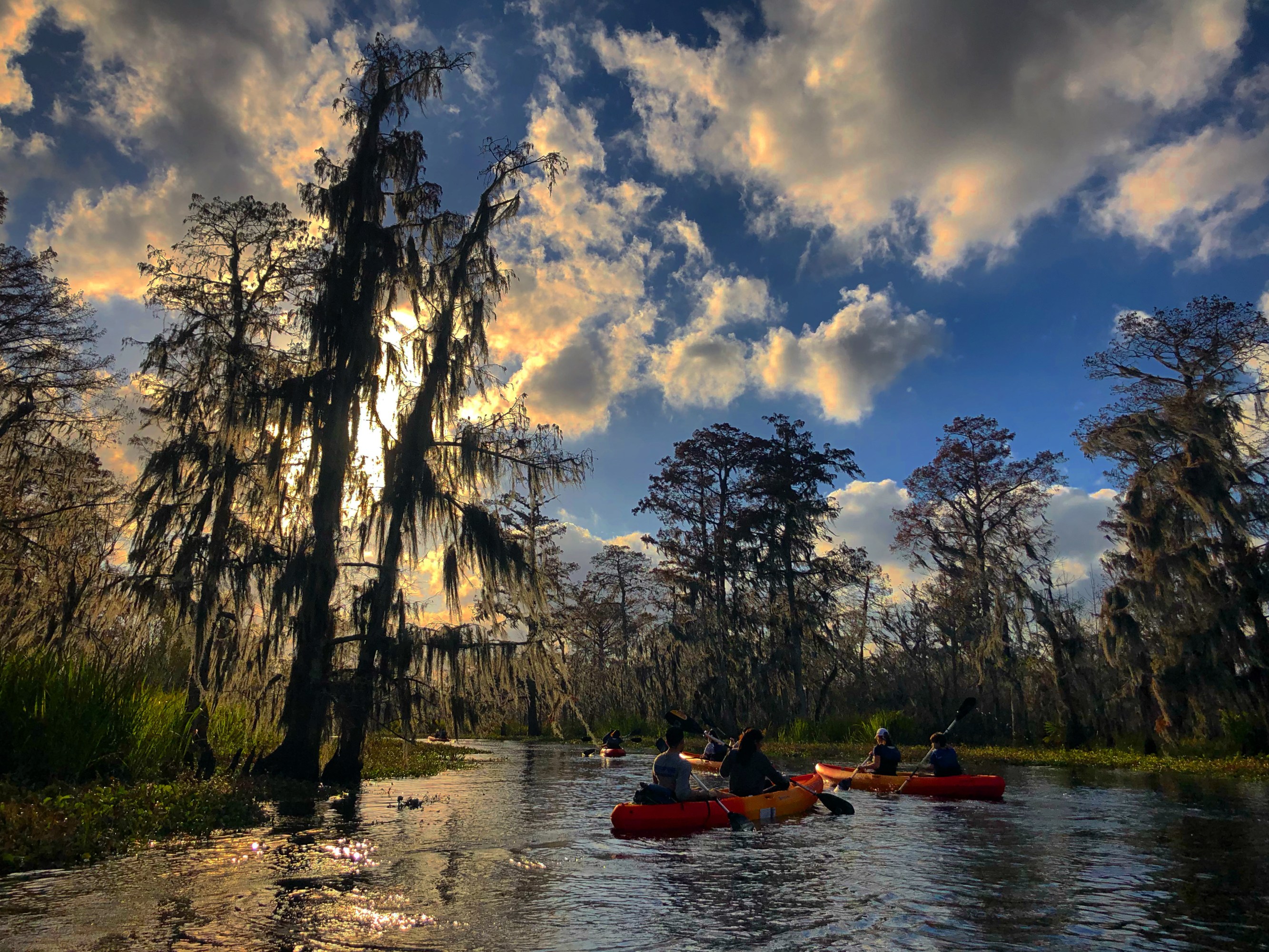
Pass Manchac is the coastal channel, roughly 7 miles long, connecting Lake Maurepas to Lake Pontchartrain. It splits into a North Pass and a South Pass around Jones Island, and there’s a historic Pass Manchac Lighthouse out there too. This is the cypress swamp: black water, Spanish moss, herons standing in the shallows, the whole southeast Louisiana picture people have in their heads.
This is the water most New Orleans kayak swamp tours actually run, ours included. When someone says “the Manchac Swamp,” this is what they mean, whether or not they realize there’s a second Manchac up the road. If you want the full story of the swamp itself, the drowned railroad towns and the ghost cypress and all of it, we put that in the deep history of the swamp itself. And if the words themselves trip you up, here’s the difference between a swamp and a bayou while we’re clearing things up.
Why they both ended up called Manchac
So why the shared name if they’re so different? Because they did the same job at different points on the same route.
Remember the back door. The old Mississippi-to-Gulf shortcut ran through both of them:
- Down the Mississippi to Bayou Manchac, the inland cutoff
- Across to the Amite River
- Into Lake Maurepas
- Through Pass Manchac into Lake Pontchartrain
- Out toward the Gulf
Both were rear entrances. Both were the back way in. The Choctaw name Imashaka fit each of them for the same reason, so it landed on both, and centuries later here we are untangling it for people who booked a kayak trip and got a history lecture instead. That’s the honest root of the confusion. It isn’t a mistake so much as two things earning the same nickname for the same reason.
Why any of this matters if you’re getting in a kayak
You might be thinking, fine, two Manchacs, who cares. Here’s why it’s worth two minutes.
If you’re planning a swamp paddle and you search “Bayou Manchac,” you’ll pull up colonial forts and river-distributary geography and directions toward Baton Rouge, none of which gets you to the cypress. The place you want is Pass Manchac and the swamp around it, out between the two lakes. Get the name right and the whole trip plan lines up: where to drive, what to expect, which tour to book. For the drive itself, we mapped out how to get to the swamp from New Orleans, and if you’re weighing your options, here’s how Manchac compares to Honey Island.
Small thing, big payoff. Nobody wants to realize they researched the wrong body of water the night before a tour.
Paddle the real Pass Manchac
We paddle Pass Manchac. Silent kayaks, small groups, a naturalist guide who can tell you which Manchac you’re on and why the name goes back to a Choctaw word for the back door.
Our Manchac Swamp kayak tour runs 2 hours, $65 a person, no motors, with pickup at 740 N Rampart Street in New Orleans. Low and slow, close enough to the water to hear the swamp instead of an engine. Book a morning trip if you want the fog and the quiet. Just make sure you’ve got the right Manchac in your search bar first.
Frequently Asked Questions
Is Pass Manchac the same as Bayou Manchac?
No. They share a name and not much else. Pass Manchac is a channel about 7 miles long that connects Lake Maurepas to Lake Pontchartrain, and it runs through the cypress swamp most New Orleans kayak tours actually paddle. Bayou Manchac is an inland former distributary of the Mississippi River near Baton Rouge, roughly 100 miles away. Different kind of water, different part of the state, same Choctaw name.
What does the name Manchac mean?
Manchac comes from the Choctaw and Mobilian word Imashaka, which the linguist John R. Swanton traced to a meaning close to the rear entrance, or the back door. Both waterways earned the name for the same reason. Each one worked as a back way shortcut on the old route between the Mississippi River and the Gulf, letting travelers skip the long, dangerous main mouth of the river. The name describes a function, not a spot on the map.
Which Manchac do kayak swamp tours paddle?
Pass Manchac, the coastal one. It is the channel that links Lake Maurepas, the smaller western lake, to Lake Pontchartrain, the larger eastern lake, with a North Pass and a South Pass wrapping around Jones Island. That is the cypress and black water country. Our guided Manchac Swamp kayak tour paddles this side of the family, a 2 hour trip with no motors. Bayou Manchac near Baton Rouge is not where the swamp tours run.
Why was Bayou Manchac historically important?
After 1763 it became a colonial boundary, dividing British West Florida to the north from Spanish Louisiana to the south. The British built Fort Bute at its mouth where it met the Mississippi. In September 1779 the Spanish governor Bernardo de Galvez captured Fort Bute, an opening move of Spain’s entry into the American Revolution. Explorer Pierre Le Moyne d’Iberville had first entered the bayou in 1699 and named it the Iberville River.
What does Manchac mean?
Manchac comes from the Choctaw word Imashaka, meaning roughly the rear entrance or back door. The linguist John R. Swanton traced it: im means place and ashaka means the back side. The name fit because the Manchac waterways were a back-door shortcut between the Mississippi River and the Gulf lakes, skipping the long lower Mississippi.
Keep reading: the Maurepas Swamp, Louisiana largest WMA.
Keep reading: what a bayou is, and the famous bayous of Louisiana.