The Famous Bayous of Louisiana (and What Makes Each One Special)
Louisiana has more bayous than most people could name, and honestly, more than the state itself has ever bothered to count exactly. They thread through the whole southern half of it: slow, dark, cypress-lined, some of them older than the state and a few older than the river that made them. Ask ten people to name a famous one and you’ll get Teche, Lafourche, maybe St. John if they know New Orleans. Most of the rest just blur into “the swamp.”
So here’s a proper tour of the ones worth knowing, what each is actually famous for, and where they sit on the map. I guide out here for a living, so I’ll be upfront about which one you can climb in a kayak and paddle with us at the end. That part matters. A bayou you can only read about is a lot less fun than one you can sit ten feet above at sunrise.
First, what a bayou actually is
Quick ground-clearing, because the word gets used loosely. A bayou is a slow-moving or nearly still body of water, usually a former river channel, a distributary, or a low spot that the land drains into. They don’t rush. That’s the whole character of the thing. If you want the full breakdown, we wrote up what a bayou actually is separately, but the short version is: flat land, slow water, cypress and tupelo, and a lot of history that came in and out by boat because roads couldn’t.
Louisiana’s famous bayous each got famous for a different reason. Some for culture, one for its sheer length, one for a war, one for a city. Let’s go one at a time.
Bayou Teche: the heart of Cajun country
If any bayou is the soul of Louisiana, it’s the Teche. It runs through the middle of Acadiana, past towns like Breaux Bridge and New Iberia, and it’s about as deep in Cajun country as you can get without ordering a second bowl of gumbo.
The Acadian families who were expelled from Canada in the 1700s settled along this water, and the culture they built there, the French, the food, the music, never really left. The Teche is where a lot of what the world thinks of as “Cajun” actually lives. It’s known for:
- Deep Acadian and Cajun roots, generations of families who’ve farmed and fished the same banks
- Old sugar country and the antebellum and Acadian architecture along its towns
- Some of the best crawfish and boudin you’ll find anywhere in the state
- A working, lived-in feel, less tourist swamp, more everyday Louisiana
You don’t paddle the Teche for wilderness. You paddle it, or more honestly you drive alongside it, for the culture. It’s the bayou that explains where Cajun Louisiana came from.
Bayou Lafourche: the longest main street in the world
Bayou Lafourche gets a nickname I love: “the longest main street in the world.” That’s because towns line it, house after house, for many miles down its length, so from the air it reads like one impossibly long street with water running down the middle instead of asphalt.
It was once a distributary of the Mississippi, meaning it used to carry the big river’s water down toward the Gulf before the connection was closed off. That river heritage is why the land along it is so settled. People built where the water and the good soil were. Today it’s the spine of a whole string of communities in the southern part of the state, and it’s about as clear a picture as you’ll get of how Louisiana life organized itself around moving water rather than around roads.
Bayou Manchac: the swamp that used to be a border
Now we’re getting closer to home. Bayou Manchac sits up near Baton Rouge, and like Lafourche it was once a distributary of the Mississippi, carrying river water east toward the lakes. But its claim to fame is stranger than most people expect. It was an international border.
After the 1760s, Bayou Manchac became the line between British and Spanish territory, a colonial boundary running right through the cypress. A sleepy swamp channel was, for a stretch, a piece on the board of empires. We tell that whole story in our post on the colonial-border history, and it’s worth reading, because almost nobody driving past today has any idea.
One thing to keep straight: there’s a Bayou Manchac up by Baton Rouge and a Pass Manchac down between the lakes near New Orleans, and people mix the two Manchacs up constantly. Same name, different water. The one you can paddle with us is Pass Manchac, and we’ll come back to it.
Bayou St. John: the bayou that built New Orleans
Here’s the one hiding in plain sight. Bayou St. John runs right through the middle of New Orleans, and without it the city might not sit where it does at all.
Long before the French arrived, Indigenous peoples used it as part of a portage route, a shortcut from Lake Pontchartrain toward the high ground along the Mississippi. When Bienville chose the spot to found New Orleans in 1718, that back-door water route was a big reason why. So the city grew up around a bayou. These days it’s a calm, tree-lined ribbon through the Mid-City neighborhoods, popular with paddlers, and it’s a favorite in-city paddle. We wrote a whole guide on how to kayak Bayou St. John if you want the easy, urban version of a Louisiana bayou. It’s the one you can do on a weeknight.
The Atchafalaya Basin: not a bayou, a whole world of them
I’m bending the list a little here, on purpose. The Atchafalaya isn’t a single bayou. It’s the largest river-swamp basin in the United States, a vast tangle of water and cypress threaded with countless bayous, and no roundup of famous Louisiana water is honest without it.
Think of it as the wild extreme of everything the other bayous hint at. It’s known for:
- Being the biggest river-swamp basin in the country, a genuine wilderness
- Old-growth-feeling cypress and tupelo standing in open black water
- Some of the richest fishing and birding in the South
- A maze of bayous, lakes, and channels where you can lose the sound of the highway completely
- A working culture of fishermen and crawfishermen who still run it for a living
- A scale that’s hard to believe until you’re inside it, water in every direction
It’s the deep end. Most visitors never get past the edge of it, and that’s fine, because you don’t need to travel that far to sit in a real cypress swamp. Which brings me to the one we run.
Pass Manchac: the one you can actually paddle with us
Here’s where I stop narrating the map and hand you a paddle. The bayou country we guide is the Manchac and Pass Manchac area, the swamp strung between Lake Maurepas and Lake Pontchartrain, and it might be the best of both worlds on this whole list. It’s got the wilderness feel of the Atchafalaya and the drowned-town, ghost-cypress history the ghost tours love, but it sits close enough to New Orleans that you can be back in the city for a late lunch.
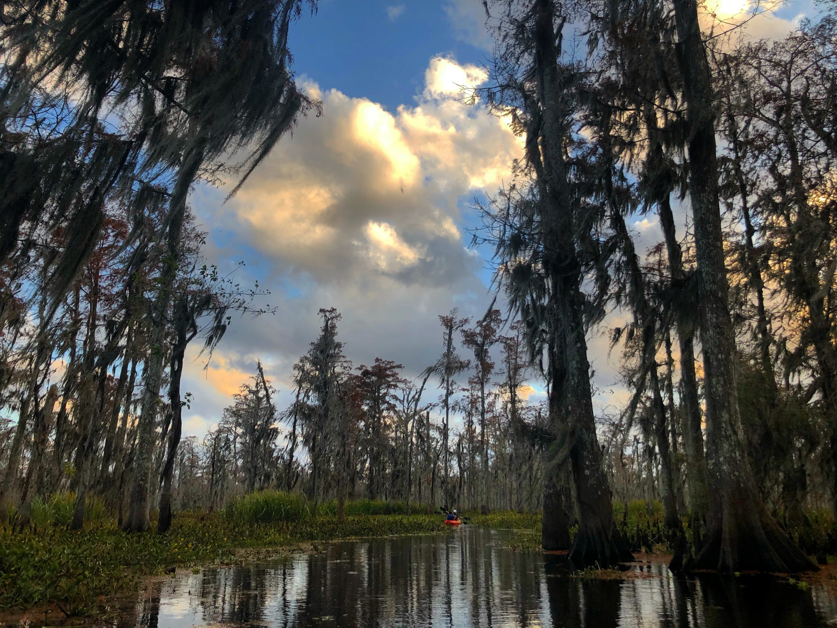
This is the stretch with the bare gray “ghost” cypress standing in still water, the herons, the gators cruising low, and the old railroad towns the water swallowed a century ago. It connects into the wider Maurepas swamp country, which is some of the largest protected swamp in the state. And the way you should see it, I’ll say this flatly, is low and slow, from a kayak, not gunning through it behind a loud engine.
That’s the whole reason we exist. Our Manchac Swamp kayak tour is a two-hour guided paddle in a small group, $65 a person, with a naturalist guide who covers the history and the wildlife as you go. No motors. We pick you up at 740 N Rampart Street in New Orleans, so you don’t need a car or a plan, just show up. You read about six famous bayous today. This is the one you can go sit inside of. See the swamp the right way.
Frequently Asked Questions
What are the most famous bayous in Louisiana?
The best-known are Bayou Teche in the heart of Cajun country, Bayou Lafourche (often called the longest main street in the world), Bayou Manchac near Baton Rouge, and Bayou St. John running through New Orleans. The Atchafalaya Basin, though not a single bayou, is the largest river-swamp basin in the country and belongs on any list of famous Louisiana water.
What is Bayou Teche known for?
Bayou Teche is known as the heart of Cajun country. It runs through Acadiana past towns like Breaux Bridge and New Iberia, and it carries deep Acadian and Cajun cultural history: the French language, the food, the music, and generations of families who settled along its banks after being expelled from Canada. It’s more about living culture than wilderness paddling.
Which Louisiana bayou can you kayak near New Orleans?
Two good options. Bayou St. John is a calm, in-city paddle running right through New Orleans, easy and urban. For a real swamp, the Manchac and Pass Manchac area between Lake Maurepas and Lake Pontchartrain gives you ghost cypress, alligators, and drowned-town history. We run a guided two-hour kayak tour there with pickup at 740 N Rampart Street.
Is the Atchafalaya Basin a bayou?
Not exactly. The Atchafalaya Basin is the largest river-swamp basin in the United States, a huge wilderness of cypress and water threaded with countless individual bayous rather than being one bayou itself. People lump it in with Louisiana’s famous bayous because it’s the deepest, wildest example of the same swamp landscape, just on a much bigger scale.